|
|
|
Home | Forums |
Downloads | Gallery |
News & Articles | Resources |
Jobs | FAQ |
| Join |
Welcome !
|
4 Users Online (2 Members):
Show Users Online
- Most ever was 626 - Mon, Jan 12, 2015 at 2:00:17 PM |
Forums
|
Forums >> Revit Building >> Technical Support >> importing Topography
|
|
|
active
Joined: Mon, Jun 7, 2004
22 Posts
No Rating |
I have followed the tutorials on importing topo from CAD and have created a surface. The problem is that after it is created the, Revit surface isn't exactly the same as the cad file. It is off by as much as 10' between contours. Any help?
|
This user is offline |
|
 | |
|
|
active

Joined: Sun, Mar 27, 2005
208 Posts
 |
very strange. lots of possibilities though.
when you created the toposurface, did you use the imported points method? if so, then maybe the cad file was not 'correct' by this 10'?
did you trace the contours using the in place point way? this should emulate it fine, so that may be no good.
if the contours nearly match in shape but are off by that 10', then the cad file has incorrect z coordinates. just move them, if so.
if the contours do not match in shape or z, then the cad file points are off. in this case create toposurface using points on the contour lines.
eldados or mr spot here in brisbane may have better answers.
|
This user is offline |
View Website
|
|
|
active
Joined: Mon, Jun 7, 2004
22 Posts
No Rating |
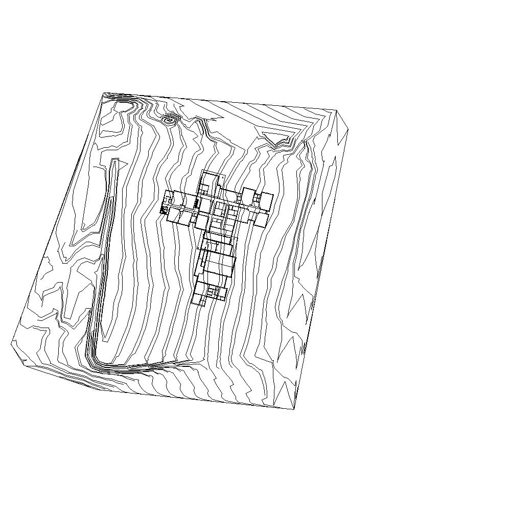
I have attached an image which shows my Revit surface and the cad contours. You will notice that they aren't parallel. My process was to use a 3D Cad surface and import using the -Import Instance- command. I thought it was something to do with the units but that was not the case. Thanks in advance for any trouble shooting efforts.
|
This user is offline |
|
|
|
active
Joined: Mon, Jun 7, 2004
22 Posts
No Rating |
I have also just tried to insert the points directly over the contour lines and have ended up with an almost identical outcome. If you edit the toposurface the points appear in the right place but when you finish sketch the contours are off. What am I doing wrong?
|
This user is offline |
|
|
|
active
Joined: Sun, Mar 27, 2005
208 Posts
|
hi again
i am a bit lost as to why this is occuring. when our office does it, usually they are very close. anyone else have an idea?
|
This user is offline |
View Website
|
|
|
active
Joined: Thu, May 6, 2004
116 Posts
 |
we tried to do same from a cad file but it gave some very odd topography, then we realised that the survey company had lots of "shrapnel" on their drawing, points that were difficult to see in cad and were on various level layers so revit was reading all these additional points as levels. We had to resort to using the cad drawing as an underlay and manually input each level point.
We have only had to do this when using other companies survey drawings, it has worked a few times perfectly well on surveys we have produced ourselves in autocad and then imported.
|
This user is offline |
|
|
|
Similar Threads |
|
Importing site plan to do a 3D topography |
Revit Building >> Technical Support
|
Sun, Jan 29, 2006 at 11:53:50 PM
|
3
|
|
Topography: importing CVS only created single line |
Revit Building >> Technical Support
|
Mon, Oct 6, 2008 at 8:38:16 AM
|
10
|
|
Creating a topography from 3D CAD survey import |
Revit Building >> Technical Support
|
Thu, Feb 23, 2012 at 7:53:01 AM
|
1
|
|
TOPOGRAPHY SPLIT PROBLEM |
Revit Structure >> Technical Support
|
Mon, Sep 22, 2008 at 2:51:42 PM
|
4
|
|
Topography |
Revit Building >> Technical Support
|
Wed, Oct 19, 2016 at 6:19:21 AM
|
2
|
|
|
Site Stats
Members: | 2161655 | Objects: | 23325 | Forum Posts: | 152479 | Job Listings: | 3 |
|