|
|
|
Home | Forums |
Downloads | Gallery |
News & Articles | Resources |
Jobs | FAQ |
| Join |
Welcome !
|
7 Users Online (5 Members):
Show Users Online
- Most ever was 626 - Mon, Jan 12, 2015 at 2:00:17 PM |
Forums
|
Forums >> Revit Building >> Technical Support >> Revit 2018 Topography map
|
|
|
active
Joined: Fri, Dec 13, 2013
0 Posts
 |
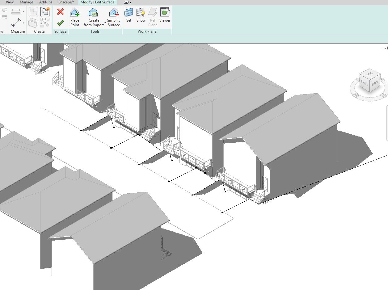
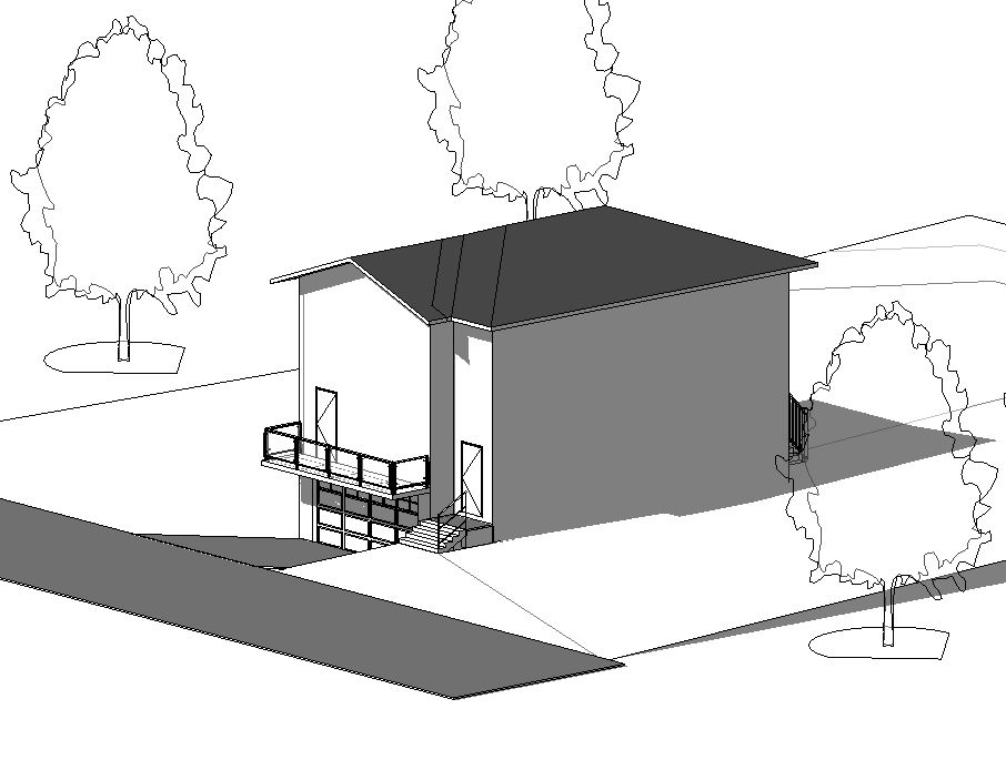
Good afternoon I am creating a mass model subdivision with Drive under Town House garages for SD. The t/o slab for the garage is set at roughly -2-3' below the road. I have attached a sample of my mass model. I have put calc points at the front entry stairs, t/o road and t/o slab garage. Used a floor with slope arrow top create a sloped driveway.
I have roughly 30 houses along the street that all have same condition.
This seems like a lot of effort to build this plan. Does anyone have any suggestions on a quicker or easier way to create the topo. I added a really prelim section, elevations to show intent for each house along the street.
Cheers
|
This user is offline |
|
 | |
|
|
active

Joined: Mon, Nov 19, 2007
93 Posts
 |
If the relationship of the points to each other is exactly the same for each house. Set one set of points up for one house, then copy it in plan to the next one, then with those copied points selected, shift your view to elevation and lower/raise them to suit the next house.
Alternatively, you could just use a pad and flatten the topo-surface underneath the and create an external family that represents the ramp buildup.
Topo-surfaces do take some time to do. In an ideal world, they would be done by the person best placed to do them - that is the landscape architect or civil engineer. Unfortunately, Revit has forgotten that either of these guys actually exist, and hasn't bothered to make much of an effort to develop tools specifically for them. Shame really.
-----------------------------------
__________I'm the guy they come to when they didn't follow my recommended workflows.__________ |
This user is offline |
|
|
|
active
Joined: Fri, Dec 13, 2013
0 Posts
|
Cheers. I did just that. Created one topo at one location and copied the points. It is not a very versatile tool!
|
This user is offline |
|
|
|
Similar Threads |
|
Issues with Topography |
Revit Building >> Technical Support
|
Mon, Apr 18, 2005 at 1:22:56 AM
|
4
|
|
Revit 2009: Mapping an aerial image to topography |
Revit Building >> Technical Support
|
Thu, Jun 18, 2009 at 10:14:53 AM
|
6
|
|
site map? |
General Discussion >> Revit Project Management
|
Thu, Oct 4, 2007 at 3:31:36 PM
|
3
|
|
Copying elements from old project to a new one in Revit 2018 |
Revit Systems >> Technical Support
|
Wed, Apr 11, 2018 at 3:32:49 PM
|
1
|
|
REVIT users map |
Community >> Newbies
|
Wed, Sep 27, 2006 at 12:14:05 PM
|
1
|
|
|
Site Stats
Members: | 2161655 | Objects: | 23325 | Forum Posts: | 152479 | Job Listings: | 3 |
|