|
Forums >> Community >> The Studio >> what is the easy to do toposurface
|
|
|
active
Joined: Wed, Oct 12, 2005
26 Posts
No Rating |
i got the survey plan from surveyor, i do not know how to use the toposurface?
onho
|
This user is offline |
|
 |
|
|
|
active
Joined: Wed, Feb 1, 2006
1 Posts
No Rating |
Open up your site plan view then file import your topo dwg file, check the current view only. On the site design tab click toposurface then click use imported>>Import Instance then pick your imported dwg on screen then on the pop up dialog box you can just click ok then lastly click finish surface.
Hope this helps....
|
This user is offline |
|
|
|
active
Joined: Tue, Dec 2, 2003
36 Posts
No Rating |
Make certian that the drawing you received from the surveyor has the Z coordinates for the contours. Not always included. You can go into the drawing and maually set them, if necessary.
Also, often the civil or surveyor's drawing will be in decimal units and your drawing will be in architectural units. I usually will take the surveyor's drawing and save it as a different name. Then I will change the units from decimal to architectural and then scale the drawing a 12 times for the unit conversion.
Import as razorback describes and then majic happens.
I still haven't gotten the 'Relocate Project' trick as yet. When you import topo, it will come in at actual grade levels while your project is usually set at 0' elevation. Relocating the project relocates the topo also, so you keep chasing the grades.
|
This user is offline |
View Website
|
|
|
active
Joined: Wed, Oct 12, 2005
26 Posts
No Rating |
it is help a little, but my topo does not look right...
The highest point RL 50.00 should happen at the left hand side, and the lowest point is right hand side. the result is totally wrong.
onho
|
This user is offline |
|
|
|
active
Joined: Tue, Dec 2, 2003
36 Posts
No Rating |
why8888,
Can you post your original .dwg file from the surveyor?
|
This user is offline |
View Website
|
|
|
active
Joined: Wed, Oct 12, 2005
26 Posts
No Rating |
Here is the original copy of dwg. file
onho
|
This user is offline |
|
|
|
active
Joined: Tue, Dec 2, 2003
36 Posts
No Rating |
Did you forget to attach the .dwg file? Notice there is a 2Mb limit on the file size.
|
This user is offline |
View Website
|
|
|
active
Joined: Wed, Oct 12, 2005
26 Posts
No Rating |
i am sorry that file it over 2mb. i can't attach
onho
|
This user is offline |
|
|
|
active
Joined: Tue, Dec 2, 2003
36 Posts
No Rating |
why8888,
Try saving the file as a different name, delete all the extraneous layers except the contour data, purge the file then saveas again with the same file name. If necessary, zip the file and see if this reduces the file size. Saveas again removes all the historical data since the renaming.
|
This user is offline |
View Website
|
|
|
active
Joined: Wed, Oct 12, 2005
26 Posts
No Rating |
here you are
|
This user is offline |
|
|
|
|
|
active
Joined: Tue, Dec 2, 2003
36 Posts
No Rating |
why8888,
Your dwg file worked okay for me. The file you attached had no values for any of the Z coordinates, so I merely added the value you had as contour notes. I then copied the contours without text onto a clean and blank dwg file, changed the units to architectural and scaled the contours at 12X. There was some sort o white box to the right of your drawing that I couldn't get close to. It would disappear when I zoomed in and would move. I toggled the frames, thinking it may be an inserted image.
|
This user is offline |
View Website
|
|
|
active
Joined: Tue, Dec 2, 2003
36 Posts
No Rating |
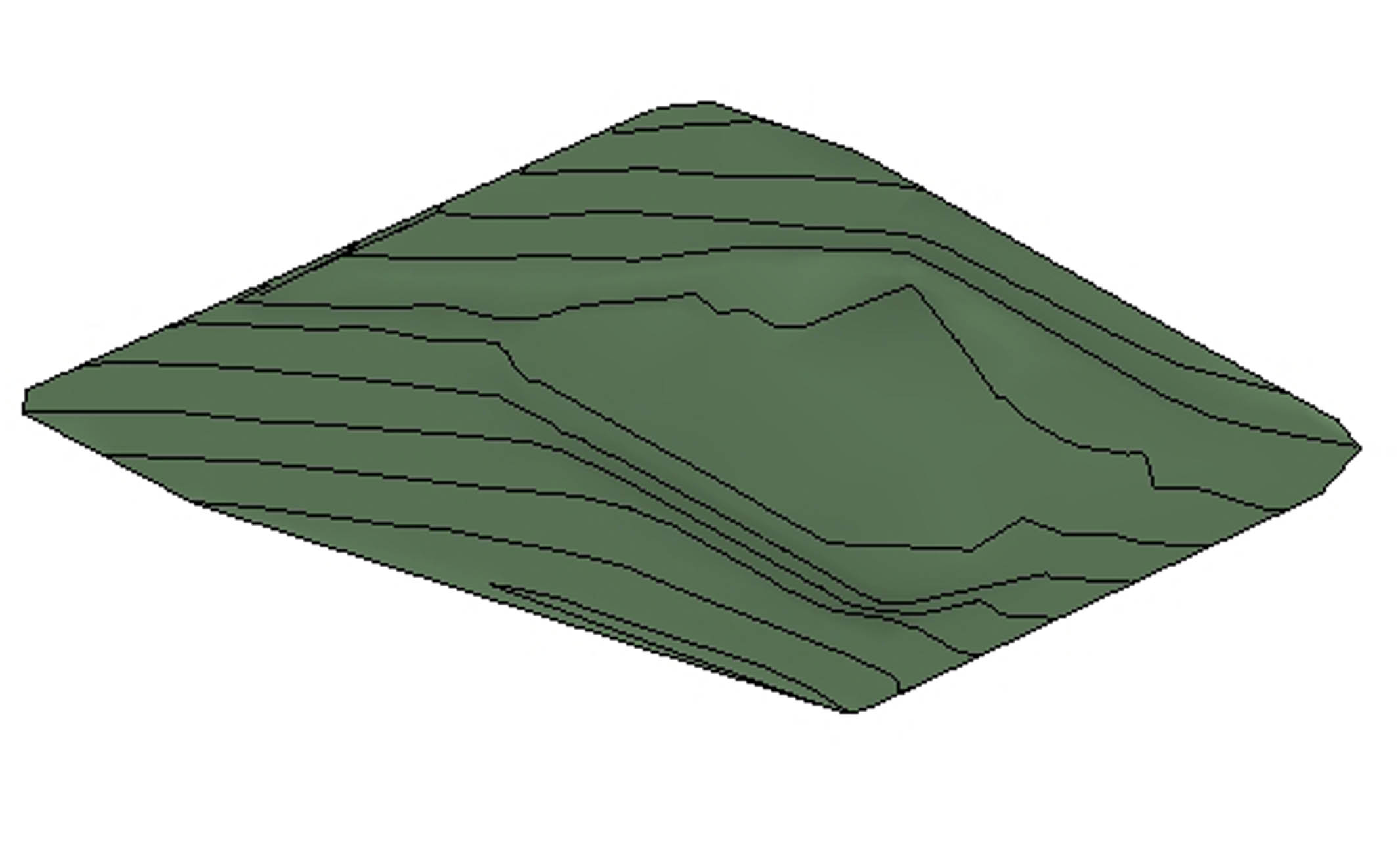
why8888, Here is a larger version. I couldn't preview the previous attachment.
|
This user is offline |
View Website
|
|
|
active
Joined: Wed, Oct 12, 2005
26 Posts
No Rating |
thanks i will try it now.
onho
|
This user is offline |
|
|
|
active
Joined: Wed, Oct 12, 2005
26 Posts
No Rating |
i don't understand how you place the z-coordinate
onho
|
This user is offline |
|
|
|
active
Joined: Tue, Dec 2, 2003
36 Posts
No Rating |
Open your surveyor's drawing in AutoCAD. Select a contour line and open the properties dialog box. Depending on the way you are setup, the 2nd section down should be GEOMETRY. About 3/4 down there will be a line named ELEVATION. There, to the right, you will be able to enter the elevation value of the contour line you selected. Do this for each of your contour lines.
Your drawing may have this information entered already. I notice that often when I copy, paste, scale, etc. that the contour lines will lose these values and they need to be entered manually.
Also, you may NOT have the option of ELEVATION, but will see X Y and Z coordinates where the Z coordinate is the value of the elevation. Simply enter your information there.
Someone else may have a simpler method.
|
This user is offline |
View Website
|
|
|