Forums
|
Forums >> Revit Building >> Technical Support >> Toposurface problem
|
|
|
active
Joined: Tue, Feb 2, 2010
2 Posts
No Rating |
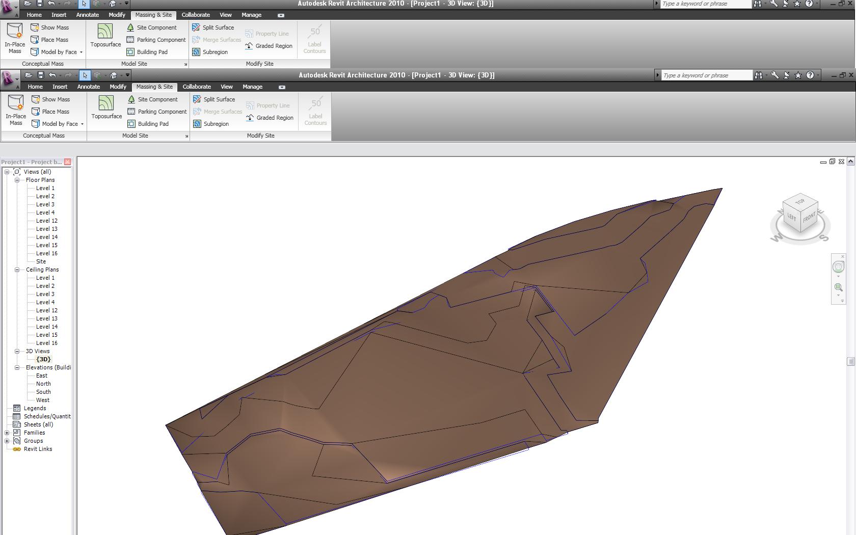
I´m trying to create a toposurface from a CAD file but revit does not follow the CAD lines, it goes through them. I hope the images can help explaining it.
|
This user is offline |
|
 | |
|
|
active
Joined: Fri, Nov 7, 2008
135 Posts
 |
It looks like it worked fairly perfectly there, I don't understand what you want to accomplish different to this ?
-----------------------------------
- Just trying to help out while I wait in the office for my renders to complete www.danrossiter.co.uk |
This user is offline |
View Website
|
|
|
active

Joined: Tue, Feb 19, 2008
71 Posts
 |
IF ALL THE LINES ARE 3D POLYLINES THEN I WOULD SAY THE CONTOUR LINES ARE TO FAR APART
|
This user is offline |
|
|
|
active
Joined: Tue, Feb 2, 2010
2 Posts
No Rating |
The blue lines are the lines that revit was suposed to follow, but it makes those black lines, not in the desired position And the cad drawing has no polylines, its exploded
|
This user is offline |
|
|
|
active
Joined: Fri, Nov 7, 2008
135 Posts
|
The black lines are every meter high, to denote the topography, there serve no other purpose, they aren't part of your topography as such, merely a form of showing the change in surface
-----------------------------------
- Just trying to help out while I wait in the office for my renders to complete www.danrossiter.co.uk |
This user is offline |
View Website
|
|
|
site moderator|||

Joined: Tue, May 22, 2007
5921 Posts
 |
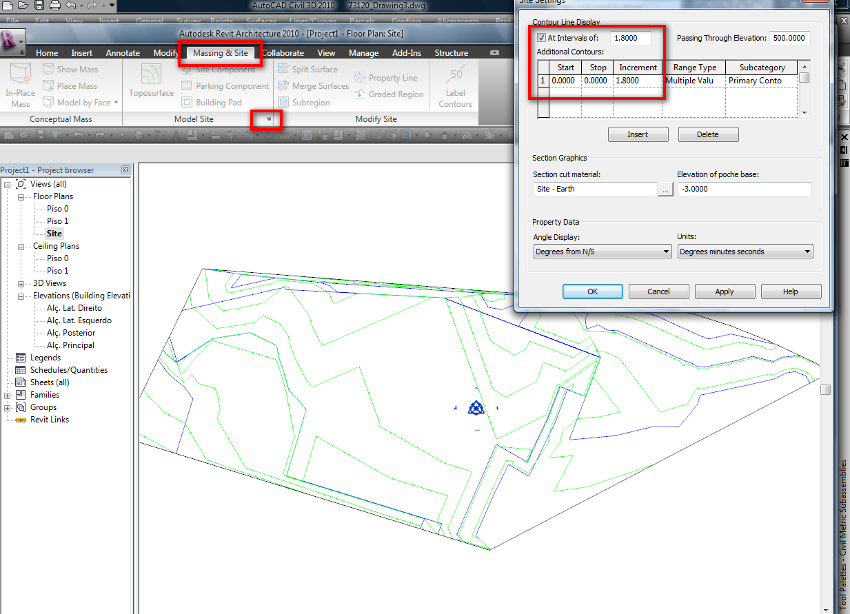
Revit is not a CIVIL program like Autocad Civil 3D, but, you also have in Revit, the "Site Settings" where you can adjust more or less the interval of your contour lines....
-----------------------------------
I Hope and I Wish to LEARN more, and more, and more.... REVIT |
This user is offline |
|
|
|
active
Joined: Tue, Feb 19, 2008
71 Posts
|
OH, THAT IS A UGLY CAD FILE!!!!! THE DOUBLED UP LINES ARE A MESS. AND I WOULD MAKE THE CONTOURS CONNECTED POLYLINES. NOT SUPRISED IT IS GOOFY ON YOU
|
This user is offline |
|
|
|
active

Joined: Fri, Sep 22, 2006
759 Posts
|
Generally Revit is using spot elevations and creating its own contours. Looks like you are attempting to create a pad on the site that is raised or lowered. You would be better served to not use contours in the import but spot elevations, if this is from a surveyor. If you created the contour lines in ACAD, that is not how Revit works. Set just a few spot elevation in Revit directly to create the original contours and then use pad tool to create the pad you want.
|
This user is offline |
|
|
|
active
Joined: Fri, Sep 22, 2006
759 Posts
|
Additional hint. If you place a spot elevation just above and or below a contour elevation you can move the contour around. Import your cad drawing as a background only. Then place spot elevation not at the contour elevation and revit will create the contours. You can keep adjusting the position of your spot elevations until you can very nearly match the contours that were originally there. Then ad the pad.
|
This user is offline |
|
|
|
Similar Threads |
|
toposurface problem!!! |
Revit Building >> Technical Support
|
Fri, Nov 5, 2010 at 7:40:03 AM
|
7
|
|
Toposurface |
Revit Building >> Tips & Tricks
|
Tue, May 11, 2010 at 9:04:45 AM
|
7
|
|
A toposurface problem? |
Community >> The Studio
|
Mon, Sep 18, 2006 at 9:16:10 AM
|
4
|
|
Flat Toposurface |
Revit Building >> Technical Support
|
Thu, Aug 3, 2017 at 8:58:49 AM
|
6
|
|
Toposurface&subregion problems |
Community >> The Studio
|
Thu, Apr 16, 2009 at 1:47:06 AM
|
6
|
|
|
Site Stats
Members: | 2161655 | Objects: | 23325 | Forum Posts: | 152479 | Job Listings: | 3 |
|