|
|
|
Home | Forums |
Downloads | Gallery |
News & Articles | Resources |
Jobs | FAQ |
| Join |
Welcome !
|
7 Users Online (5 Members):
Show Users Online
- Most ever was 626 - Mon, Jan 12, 2015 at 2:00:17 PM |
Forums
|
Forums >> Revit Building >> Technical Support >> Create Toposurface
|
|
|
active
Joined: Fri, Oct 3, 2008
25 Posts
No Rating |
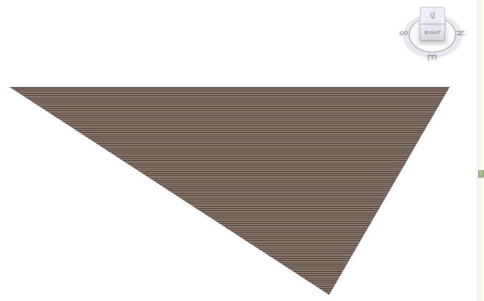
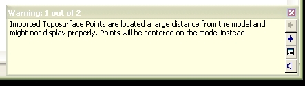
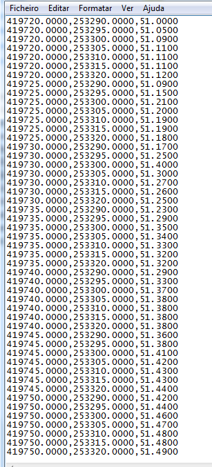
Hello. im having problems creating a toposurface. i have a dxf from promap that has 3d point data. i extract only the x,y,z data into a csv file using autocad and import that into revit as a points file. example of 3d data attached and a warning and what i see after importing it (the site should be square with a river running through it not a flat triangle!!) - i have tried this before and the solution was to alter the point x,y positions to 0,0 so the data looked more like 0,0,5 but all that does this time is make a single line! the x,y grids are 5x5m so the change in levels wont be a lot (apart from in the river) you can see this in the point data. can anyone kindly help me get out of this one?
|
This user is offline |
|
 | |
|
|
site moderator|||

Joined: Tue, May 22, 2007
5921 Posts
 |
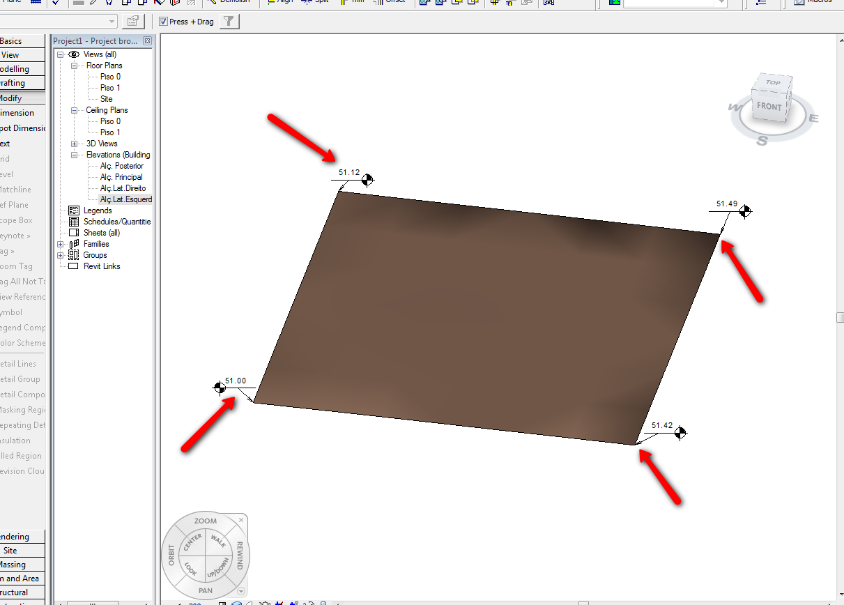
Did you check the Help menu??? NOW, are you seeing you csv file? (the site should be square with a river running through it not a flat triangle!!) - like you can see in the second image i use your csv file (like you can see in the thirth image), i don't know where is the "river" because the difference (Z) between the points are small (5, 10cm)....
-----------------------------------
I Hope and I Wish to LEARN more, and more, and more.... REVIT |
This user is offline |
|
|
|
active
Joined: Fri, Oct 3, 2008
25 Posts
No Rating |
Thanks Typoon. I hadnt realised (working too quickly) that even tho i asked Autocad data extraction to only give me XYZ data it still added 2 extra columns! hence why it wasnt working. i posted only a small section of the data so the river wasnt included. cheers
|
This user is offline |
|
|
|
Similar Threads |
|
Flat Toposurface |
Revit Building >> Technical Support
|
Thu, Aug 3, 2017 at 8:58:49 AM
|
6
|
|
Create tunnel within toposurface |
Community >> Newbies
|
Mon, Jul 7, 2014 at 8:58:04 AM
|
1
|
|
Using Survey Data to create a toposurface |
Revit Building >> Tips & Tricks
|
Mon, Oct 4, 2010 at 2:23:28 PM
|
7
|
|
Toposurface |
Revit Building >> Tips & Tricks
|
Tue, May 11, 2010 at 9:04:45 AM
|
7
|
|
importing topo info into RAC 2010 to create a toposurface |
Revit Building >> Technical Support
|
Thu, Apr 29, 2010 at 1:12:40 PM
|
4
|
|
|
Site Stats
Members: | 2161655 | Objects: | 23325 | Forum Posts: | 152479 | Job Listings: | 3 |
|